IMPROVING YOUR LAKE MAPS
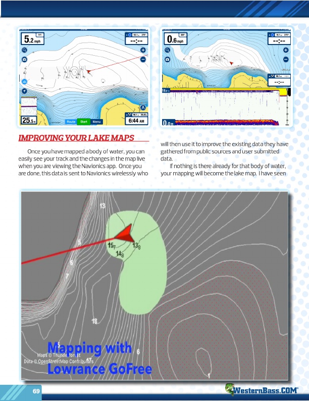
Once you have mapped a body of water, you can easily see your track and the changes in the map live when you are viewing the Navionics app. Once you are done, this data is sent to Navionics wirelessly who
will then use it to improve the existing data they have gathered from public sources and user submitted data.
If nothing is there already for that body of water, your mapping will become the lake map. I have seen
69 ®