Also, electromagnetic interference from your outboard may affect your Point-1 accuracy, so you want it away from it as well. To determine if your Point-1 location will be affected, simply duct tape it temporarily in place and test it, before drilling holes. My splash well location did not degrade the compass accuracy.
My setup solution. Remember that when you see a waypoint on your screen, it is displayed in relation to the GPS antenna that is in use. Since I have two HDS units in operation at the same time, I want each unit to display the proper direction and distance to the waypoint from each HDS unit, so that when I move from one HDS to the other I will still know exactly where the waypoint is in relation to where I am standing or sitting.
Mounting the Point-1. Mount the Point-1 on or near the splash well fiberglass or deck. My LSS-2 StructureScan transducer is mounted to my jack plate with a Transducer Shield and Saver mount. My sonar transducer is epoxied in the hull just forward of my drain plug. I mounted my Point-1 as close as possible to both transducers (in-between), but also as far as possible from my outboard.
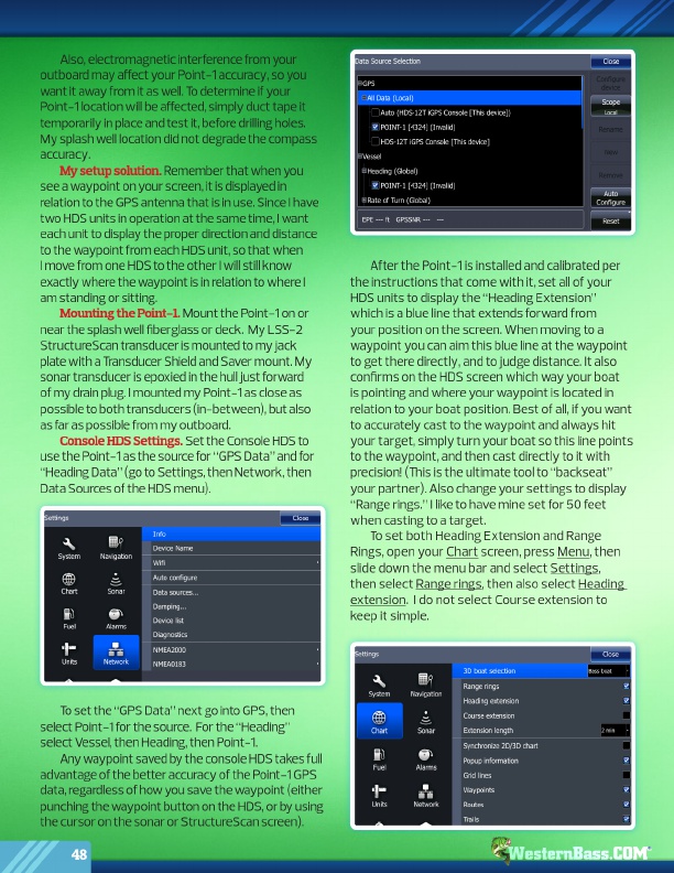
Console HDS Settings. Set the Console HDS to use the Point-1 as the source for “GPS Data” and for “Heading Data” (go to Settings, then Network, then Data Sources of the HDS menu).
After the Point-1 is installed and calibrated per the instructions that come with it, set all of your HDS units to display the “Heading Extension” which is a blue line that extends forward from your position on the screen. When moving to a waypoint you can aim this blue line at the waypoint to get there directly, and to judge distance. It also confirms on the HDS screen which way your boat is pointing and where your waypoint is located in relation to your boat position. Best of all, if you want to accurately cast to the waypoint and always hit your target, simply turn your boat so this line points to the waypoint, and then cast directly to it with precision! (This is the ultimate tool to “backseat” your partner). Also change your settings to display “Range rings.” I like to have mine set for 50 feet when casting to a target.
To set both Heading Extension and Range Rings, open your Chart screen, press Menu, then slide down the menu bar and select Settings, then select Range rings, then also select Heading extension. I do not select Course extension to keep it simple.
To set the “GPS Data” next go into GPS, then select Point-1 for the source. For the “Heading” select Vessel, then Heading, then Point-1.
Any waypoint saved by the console HDS takes full advantage of the better accuracy of the Point-1 GPS data, regardless of how you save the waypoint (either punching the waypoint button on the HDS, or by using the cursor on the sonar or StructureScan screen).
48
®