Ask The Sonar Guys is a regular feature every issue where Jeff Boyer from Sonar GPS Workshops LLC answers your questions about operating, interpreting, and getting the most from your sonar and gps units. Email any questions you may have to jeff@sonargpstraining.com, and Jeff will pick one or
two to answer in the next issue. The next question could be yours, so send them in.
when the structure is in the cone angle, also keep in mind the deeper the water column, the wider the cone angle, which introduces even greater probability the structure is not directly below the boat. Hopefully you are grasping the error potential in play when you create waypoints in this manner to mark structure.
You are setting yourself up for frustration and wasted time because you are visualizing your waypoint is directly over your structure, when in reality that is likely not true. Worse yet, if it isn’t where you think it is, then you can’t even be sure where it is in relation to the waypoint. This is about the time you’re telling yourself, “it has to be here somewhere!” and that’s no way to fish effectively.
Minimize this chance for inaccuracy whenever marking structure with waypoints by using the cursor instead. Place the cursor on the structure, then create a “cursor position” waypoint. refer to diagram 2 and note the cursor is placed on the far right structure to create Waypoint 2. This is a much more accurate approach, and doesn’t rely on
boat position whatsoever, as you can see on the map screen on the left.
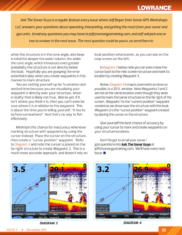
in diagram 3 below note you can even move the cursor back to the mid-screen structure and mark its location by creating Waypoint 3.
Below, diagram 4’s map is zoomed in as close as possible, to a 20 ft. window. Note Waypoints 1 and 2 are not at the same location, even though they were used to mark the same structure on the far right of the screen. Waypoint 1 is the “current position” waypoint created as we drove over the structure with the boat. Waypoint 2 is the “cursor position” waypoint created by placing the cursor on the structure.
Give yourself the best chance of accuracy by using your cursor to mark and create waypoints on your structure locations.
don’t forget to email your sonar/ gps questions into Ask The Sonar Guys at jeff@sonargpstraining.com. We’ll have more next issue.
DiAgrAM 3
Issue 5 December 2011
DiAgrAM 4
23
mailto:jeff@sonargpstraining.com