water levels, it has made me very familiar with reading contour lines and how they affect the fish’s movement.
DOIN’ WORK
once i have the maps and have thoroughly looked over each, i bring out permanent markers, highlighters, stickers and sticky notes. First, i like to look over all of the main lake points. i try to recognize if they are steep or slow sloping and how they relate to sun position. i also look for any particular areas or sections of lake that are unique such as secondary points, steep walls, or unusual shaped cuts. i like to mark previous areas that my research has told me produced fish. i mark cut-off points, the launch ramp, waypoints (if i have them from previous events on the same lake) and any other spots on the lake that i want to try. i then take the research a step further. My next approach is to examine virtual maps. again with the use of the internet, anyone has access to multiple free maps using such programs as but not limited to Google Maps and Yahoo Maps. each website usually has their own satellite images which can
show different water levels, exposing cover and structure that you might not have been able to find otherwise. if any existing rock piles, fallen trees, stumps, or man-made cover is discovered on the virtual map it is then transferred onto the paper map. Quickly you will notice that a simple paper map will become more and more detailed marks from your research.
COMPARISONS
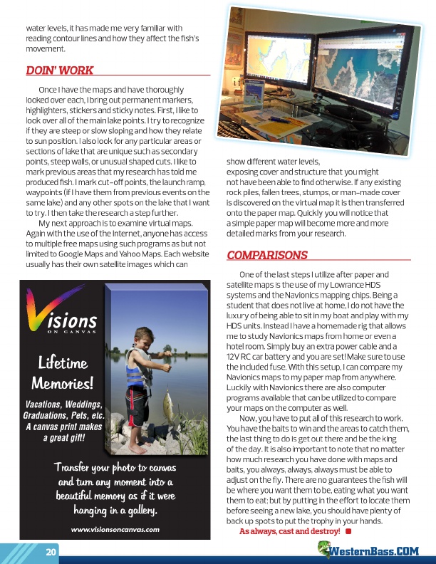
one of the last steps i utilize after paper and satellite maps is the use of my lowrance HdS systems and the Navionics mapping chips. Being a student that does not live at home, i do not have the luxury of being able to sit in my boat and play with my HdS units. instead i have a homemade rig that allows me to study Navionics maps from home or even a hotel room. Simply buy an extra power cable and a 12V rC car battery and you are set! Make sure to use the included fuse. With this setup, i can compare my Navionics maps to my paper map from anywhere. luckily with Navionics there are also computer programs available that can be utilized to compare your maps on the computer as well. Now, you have to put all of this research to work. You have the baits to win and the areas to catch them, the last thing to do is get out there and be the king of the day. it is also important to note that no matter how much research you have done with maps and baits, you always, always, always must be able to adjust on the fly. There are no guarantees the fish will be where you want them to be, eating what you want them to eat; but by putting in the effort to locate them before seeing a new lake, you should have plenty of back up spots to put the trophy in your hands. As always, cast and destroy!
Lifetime Memories!
Vacations, Weddings, Graduations, Pets, etc. A canvas print makes a great gift!
Transfer your photo to canvas and turn any moment into a beautiful memory as if it were hanging in a gallery.
www.visionsoncanvas.com
20
http://visionsoncanvas.com