®
Fall 2018
WATER LEVELS
In my summer article, I detailed the many benefits of fishing out of a kayak, when reservoirs have high water. Our ability to snake through the thickest cover really sets us apart from the rest of the bass fisherman on the lake. Many of those same reservoirs that were overflowing with water this spring are now considerably lower. Water demands downstream all summer have taken the water level down sometimes hundreds of feet and if the boat ramp is still in the water that means kayak anglers are at a disadvantage.
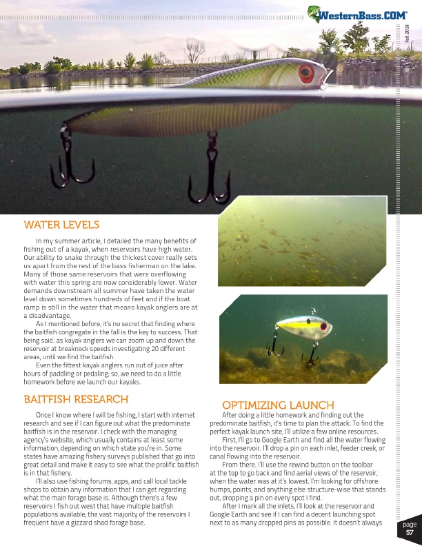
As I mentioned before, it’s no secret that finding where the baitfish congregate in the fall is the key to success. That being said. as kayak anglers we can zoom up and down the reservoir at breakneck speeds investigating 20 different areas, until we find the baitfish.
Even the fittest kayak anglers run out of juice after hours of paddling or pedaling; so, we need to do a little homework before we launch our kayaks.
BAITFISH RESEARCH
Once I know where I will be fishing, I start with internet research and see if I can figure out what the predominate baitfish is in the reservoir. I check with the managing agency’s website, which usually contains at least some information, depending on which state you’re in. Some states have amazing fishery surveys published that go into great detail and make it easy to see what the prolific baitfish is in that fishery.
I’ll also use fishing forums, apps, and call local tackle shops to obtain any information that I can get regarding what the main forage base is. Although there’s a few reservoirs I fish out west that have multiple baitfish populations available, the vast majority of the reservoirs I frequent have a gizzard shad forage base.
OPTIMIZING LAUNCH
After doing a little homework and finding out the predominate baitfish, it’s time to plan the attack. To find the perfect kayak launch site, I’ll utilize a few online resources.
First, I’ll go to Google Earth and find all the water flowing into the reservoir. I’ll drop a pin on each inlet, feeder creek, or canal flowing into the reservoir.
From there. I’ll use the rewind button on the toolbar at the top to go back and find aerial views of the reservoir, when the water was at it’s lowest. I’m looking for offshore humps, points, and anything else structure-wise that stands out, dropping a pin on every spot I find.
After I mark all the inlets, I’ll look at the reservoir and Google Earth and see if I can find a decent launching spot next to as many dropped pins as possible. It doesn’t always
page
57