GoFree™ cloud enabled. Download and upload maps, software and apps direct to your fishfinder/chartplotter.
From GoFree™, the Insight PRO™ and HD maps with high-definition shaded relief and the ability to make your own high-resolution contour maps with Insight Genesis®. And world-leading digital chart-creation partners like Jeppesen and Navionics, Lowrance® chartplotters provide you with the most mapping options to meet your navigational needs.
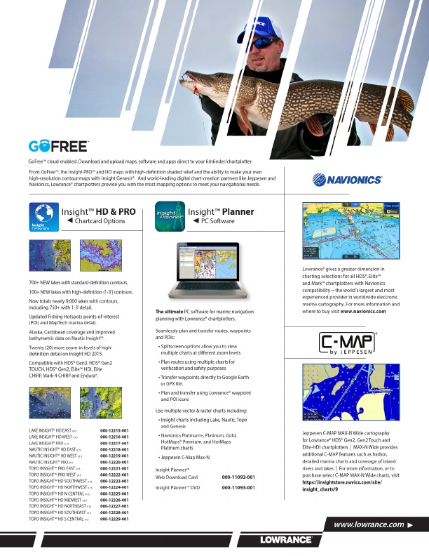
Insight™ HD & PRO
Chartcard Options
Insight™ Planner
PC Software
700+ NEW lakes with standard-definition contours. 100+ NEW lakes with high-definition (1-3') contours.
Now totals nearly 9,000 lakes with contours, including 750+ with 1-3' detail.
Updated Fishing Hotspots points-of-interest (POI) and MapTech marina detail.
Alaska, Caribbean coverage and improved bathymetric data on Nautic Insight™.
Twenty (20) more zoom-in levels of high- definition detail on Insight HD 2015.
Compatible with HDS® Gen3, HDS® Gen2 TOUCH, HDS® Gen2, Elite™ HDI, Elite CHIRP, Mark-4 CHIRP and Endura®.
LAKE INSIGHT® HD EAST V15 LAKE INSIGHT® HD WEST V15 LAKE INSIGHT® PRO V15 NAUTIC INSIGHT® HD EAST V15 NAUTIC INSIGHT® HD WEST V15 NAUTIC INSIGHT® PRO V15 TOPO INSIGHT™ PRO EAST V15 TOPO INSIGHT™ PRO WEST V15 TOPO INSIGHT™ HD SOUTHWEST V15 TOPO INSIGHT™ HD NORTHWEST V15 TOPO INSIGHT™ HD N CENTRAL V15 TOPO INSIGHT™ HD MIDWEST V15 TOPO INSIGHT™ HD NORTHEAST V15 TOPO INSIGHT™ HD SOUTHEAST V15 TOPO INSIGHT™ HD S CENTRAL V15
000-12215-001 000-12216-001 000-12217-001 000-12218-001 000-12219-001 000-12220-001 000-12221-001 000-12222-001 000-12223-001 000-12224-001 000-12225-001 000-12226-001 000-12227-001 000-12228-001 000-12229-001
The ultimate PC software for marine navigation planning with Lowrance® chartplotters.
Seamlessly plan and transfer routes, waypoints and POIs:
• Splitscreen options allow you to view multiple charts at different zoom levels
• Plan routes using multiple charts for verification and safety purposes
• Transfer waypoints directly to Google Earth or GPX file.
• Plan and transfer using Lowrance® waypoint and POI icons
Use multiple vector & raster charts including:
• Insight charts including Lake, Nautic, Topo and Genesis
• Navionics Platinum+, Platinum, Gold, HotMaps® Premium, and HotMaps Platinum charts
• Jeppesen C-Map Max-N
Insight Planner™ Web Download Card
Insight Planner™ DVD
000-11092-001 000-11093-001
Lowrance® gives a greater dimension in charting selections for all HDS®, Elite™ and Mark™ chartplotters with Navionics compatibility—the world’s largest and most experienced provider in worldwide electronic marine cartography. For more information and where to buy visit www.navionics.com
Jeppesen C-MAP MAX-N Wide cartography for Lowrance® HDS® Gen2, Gen2 Touch and Elite-HDI chartplotters | MAX-N Wide provides additional C-MAP features such as harbor, detailed marina charts and coverage of inland rivers and lakes | For more information, or to purchase select C-MAP MAX-N Wide charts, visit https://insightstore.navico.com/site/ insight_charts/9
www.lowrance.com